This is a short ride did last weekend to Gandikota and Belum caves. Was planning to these places for Quite some time, but nothing materialized. But this time made sure it had to be done, come what may. Had planned to do it solo till the evening of Friday till Bharath confirmed his presence. the ride was not that eventful except for super crazy cross winds and rains. This log will be more like more of Pics than textual content, not finding time to pen it down.
Route Taken: Bangalore-Bagepalli-Kadiri-Pulivendula-Muddanur-Jammalamadugu-Gandikota-Jammalamadugu-Kolimigundla-Belum Caves-Tadipatri-Ananthpur-Dharmavaram-Bangalore.
Gandikota aka "The grand Canyon" of India.
A brief history about the place:
Gandikota was founded in 1123 by Kapa Raja of nearby Bommanapalle village and a subordinate of Ahavamalla Someswara I, the Western Chalukyan king of Kalyana. The town played a significant role during the Kakatiya, Vijayanagara and Qutub Shahi periods. The fort was made more impregnable by Pemmasani Thimma Nayudu. The fort was under the control of Pemmasani Nayaks for over 300 years.
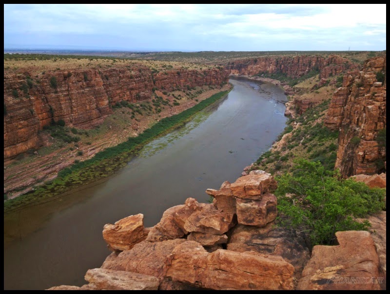
The fort of Gandikota acquired its name due to the 'gorge' (in Telugu it is called 'gandi'), formed between the Erramala range of hills, also known as Gandikota hills and the river Pennar that flows at its foot, reducing its width to a mere 300 ft (see the river image below). Situated amidst beautiful landscape and wild forests, it is endowed with vast natural resources.
Surrounded by a deep valley and impassable hills, with massive boulders of red granite and the river Pennar that flows about 300 ft. below on the west and northern sides, its location affords strong natural defence to the occupants of the Fort. The exploits of Pemmasani Nayaks, Gothram : Musunulla, Rulers of Gandikota and Commanders in Vijayanagar army to protect the honour of Telugu land are well known.
Vemana, the famous Telugu poet, native of Kadapa district and believed to have lived in Gandikota area for a short period.
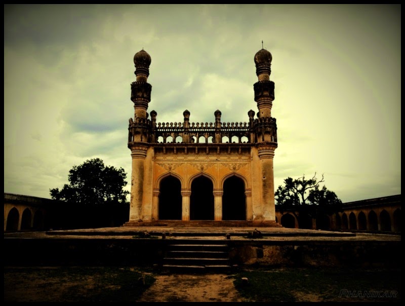
The area within is full of the debris of ages and many ancient structures in varying stages of decay. The fort has a Masjid, a large granary and a temple. The Jamia Masjid has two adjacent minarets. The large granary, with a vaulted roof, is now used as the traveller's bungalow. Within the fort are two ancient temples, dedicated to Madhava and Raghunatha. The other structures within the fort, include another large granary, a magazine, a graceful 'pigeon tower' with fretted windows and an extensive palace built by bricks with some plastered decorations and some wells. There is an old cannon still lying in the fort.
There is also the 'Rayalacheruvu' with its perennial springs irrigating some lime and plantain gardens. It is said that this 'Cheruvu' was connected to a fountain in Jamia Masjid by pipes, traces of which can still be seen. There were other gardens and springs. There is an undated inscription on a boulder, near the 'Nagajhari' outside the fort, recording the gift of two gardens at the place to the temple. There was also a garden called 'Parebagh' with a waterfall at the foot of the hills, on the bank of the Penneru.
Efforts are being put to give Gandikota a world heritage status.
Source: Wikipedia
First batch of Pics for
Somewhere Close to Kadiri
![]()
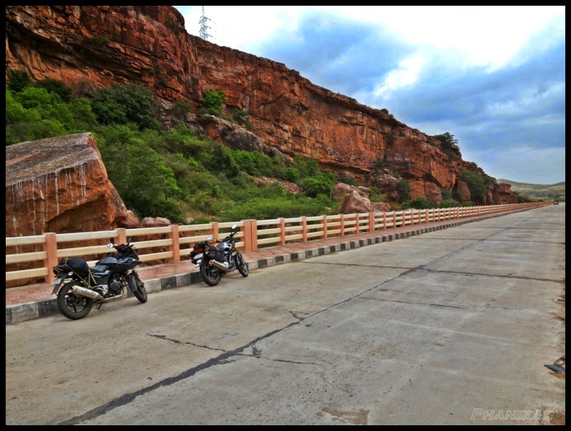
Approaching Gandikota
![]()
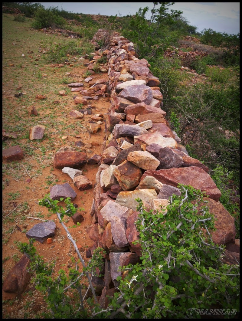
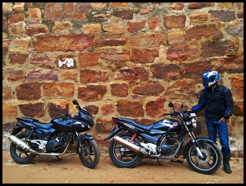
These Stone walls stopped us from taking the bikes down to the river
![]()
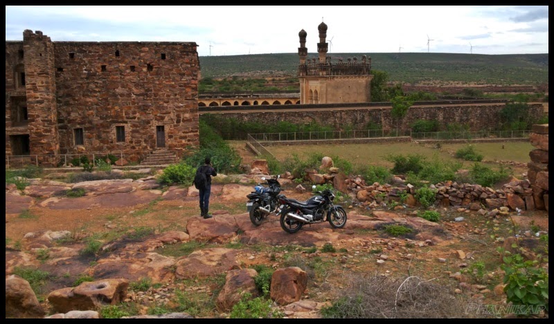
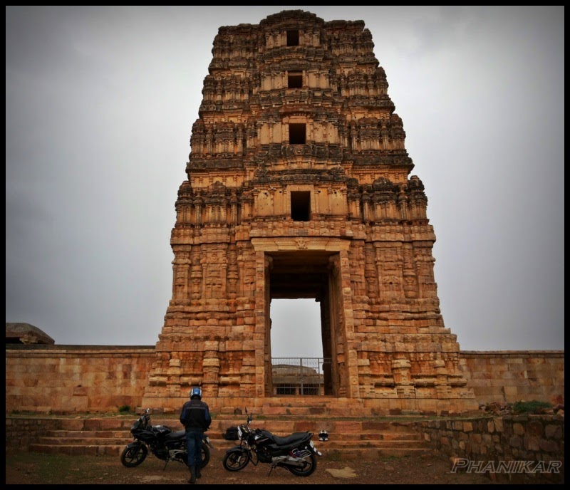
View from Raghunatha Swamy Temple
![]()
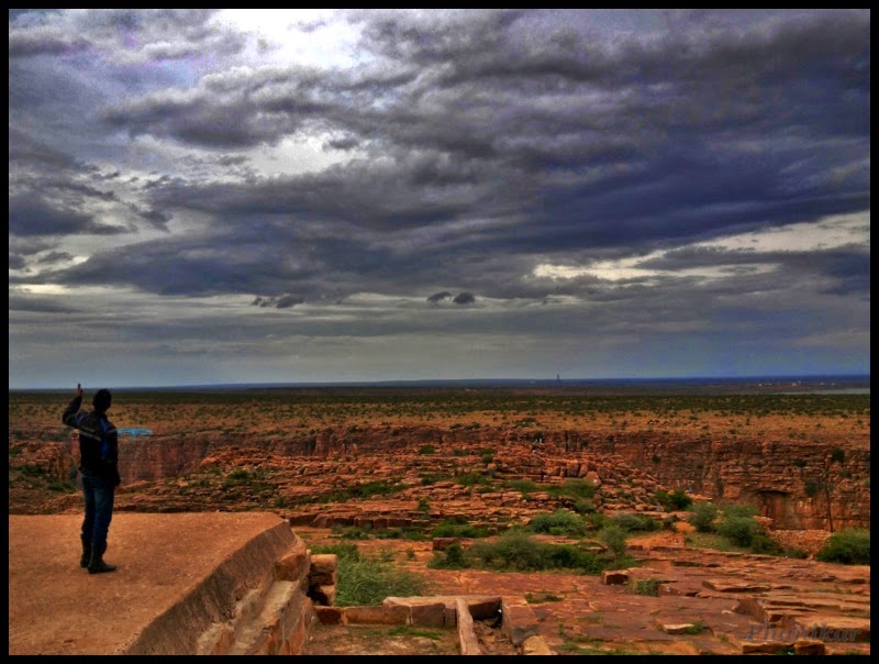
Penna Gorge, the whole point why we were there
![]()
![]()
![]()
![]()
Raghunatha Swamy Temple
![]()
![]()
![]()
![]()
Dark Clouds getting Closer and closer. View from Raghunatha Swamy Temple
![]()
The old Horses
![]()
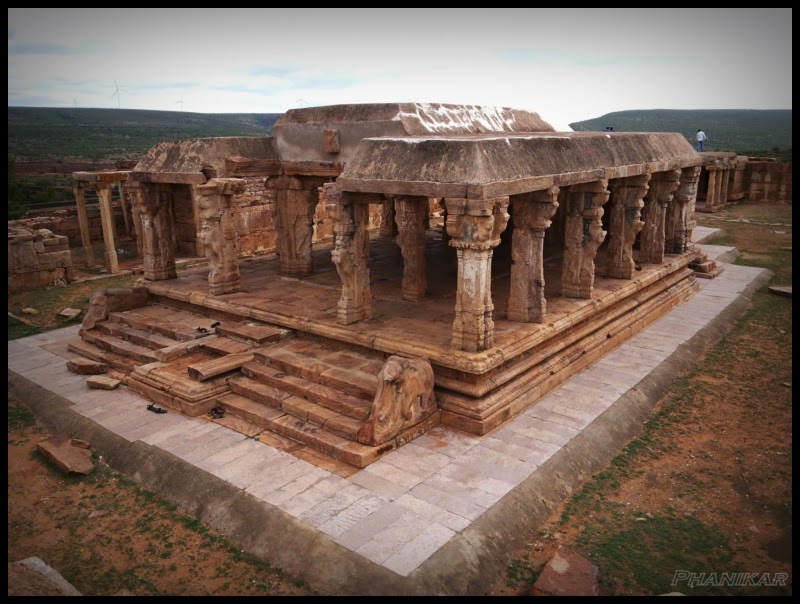
Madhavaraya temple
![]()
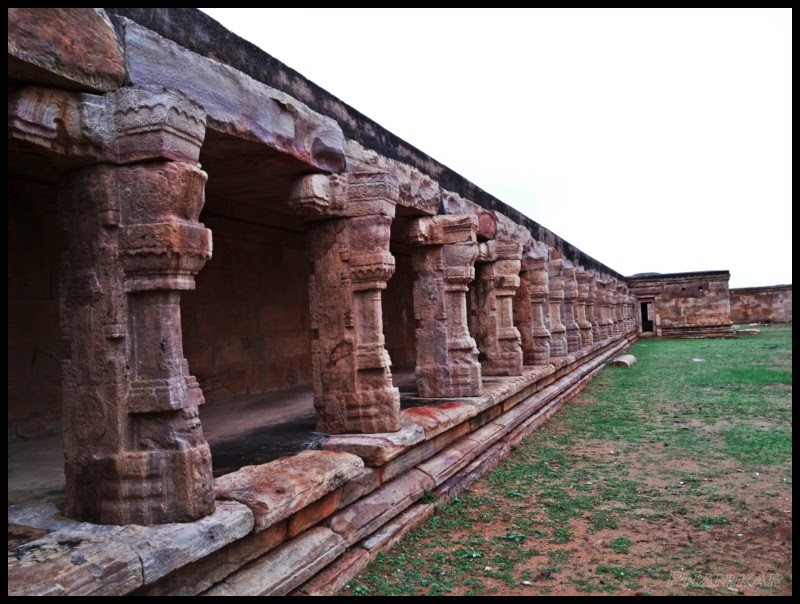
Walkways of the temple
![]()
![]()
Jama Masjid, Very Photogenic
![]()
![]()
![]()
![]()
Collage work on the Granary wall
![]()
![]()
![]()
![]()
![]()
![]()
![]()
![]()
Charminar
![]()
Outside our room
![]()
To be Continued ..........
Route Taken: Bangalore-Bagepalli-Kadiri-Pulivendula-Muddanur-Jammalamadugu-Gandikota-Jammalamadugu-Kolimigundla-Belum Caves-Tadipatri-Ananthpur-Dharmavaram-Bangalore.
Gandikota aka "The grand Canyon" of India.
A brief history about the place:
Gandikota was founded in 1123 by Kapa Raja of nearby Bommanapalle village and a subordinate of Ahavamalla Someswara I, the Western Chalukyan king of Kalyana. The town played a significant role during the Kakatiya, Vijayanagara and Qutub Shahi periods. The fort was made more impregnable by Pemmasani Thimma Nayudu. The fort was under the control of Pemmasani Nayaks for over 300 years.
The fort of Gandikota acquired its name due to the 'gorge' (in Telugu it is called 'gandi'), formed between the Erramala range of hills, also known as Gandikota hills and the river Pennar that flows at its foot, reducing its width to a mere 300 ft (see the river image below). Situated amidst beautiful landscape and wild forests, it is endowed with vast natural resources.
Surrounded by a deep valley and impassable hills, with massive boulders of red granite and the river Pennar that flows about 300 ft. below on the west and northern sides, its location affords strong natural defence to the occupants of the Fort. The exploits of Pemmasani Nayaks, Gothram : Musunulla, Rulers of Gandikota and Commanders in Vijayanagar army to protect the honour of Telugu land are well known.
Vemana, the famous Telugu poet, native of Kadapa district and believed to have lived in Gandikota area for a short period.
The area within is full of the debris of ages and many ancient structures in varying stages of decay. The fort has a Masjid, a large granary and a temple. The Jamia Masjid has two adjacent minarets. The large granary, with a vaulted roof, is now used as the traveller's bungalow. Within the fort are two ancient temples, dedicated to Madhava and Raghunatha. The other structures within the fort, include another large granary, a magazine, a graceful 'pigeon tower' with fretted windows and an extensive palace built by bricks with some plastered decorations and some wells. There is an old cannon still lying in the fort.
There is also the 'Rayalacheruvu' with its perennial springs irrigating some lime and plantain gardens. It is said that this 'Cheruvu' was connected to a fountain in Jamia Masjid by pipes, traces of which can still be seen. There were other gardens and springs. There is an undated inscription on a boulder, near the 'Nagajhari' outside the fort, recording the gift of two gardens at the place to the temple. There was also a garden called 'Parebagh' with a waterfall at the foot of the hills, on the bank of the Penneru.
Efforts are being put to give Gandikota a world heritage status.
Source: Wikipedia
First batch of Pics for
Somewhere Close to Kadiri

Approaching Gandikota
These Stone walls stopped us from taking the bikes down to the river
View from Raghunatha Swamy Temple
Penna Gorge, the whole point why we were there


Raghunatha Swamy Temple


Dark Clouds getting Closer and closer. View from Raghunatha Swamy Temple
The old Horses
Madhavaraya temple
Walkways of the temple

Jama Masjid, Very Photogenic


Collage work on the Granary wall


Charminar

Outside our room

To be Continued ..........